Orphans on the River |
iWebTech: chird@bobbittville.com
|
Orphans on the River |
iWebTech: chird@bobbittville.com
|
This intro of Norman Martin's book has been modified to conform to the
recollections of Chird Bobbitt and to include
some additional history. The book is available from Books-A-Million & Hastings
This is a non-fiction novel about two boys who became orphans early in
their life. They decided to make their home on the rivers starting at Cochran’s Bluff
where Ten Mile creek runs into the Little Red River in
White County,
Arkansas, then floated down
to the White River (called Niska by
the Quapaw Indians and La
Riviere Blanc by the French) and on to the
Mississippi. This story was told to the
author several times by Harry Churchill
while in his 90s, he was born May 7, 1899 near Newark, AR on Salado Creek in Independence County (1900 Census)
where his father Henry Churchill, (about 1844-1903) of Quincy (History), (Adams County *1)
IL, worked a homestead. Henry, in about 1897 lost this homestead back to the railroad. 1895 Map of Arkansas
The year after Henry's death, Harry and his mother Mary lived in a shack in
Denmark Township, provided by her
father-in-law, Kirkwood E. Reeves and picked strawberries. About 1905 she was asked to
move back to Ward to care for her mother's sister who was sick with consumption. Her
sister was married to a Ward and had a son named Walter and a son by a previous marriage
named Jimmy Reynolds, who never married.
Harry was thirteen years old when he and his 16 year old half-brother Flemon Benjamin Bobbitt who worked room & board with local farmers made a decision to live on the river.
How Harry Churchill and Flemon became orphans was very unusual. Their
relationship came through having the same mother, but different fathers. Flemon was born
in Craighead county where
his father John Wesley Bobbitt
owned land and ran a logging operation with a partner on or near the Cache (French for
"hidden") River . John Wesley was the youngest son of Moses L. Bobbitt, who was
born in Bedford County, TN. Moses came to Craighead County from Carroll County, TN in the
late 1830's with his mother Lodicia Bobbit (a widow) and other family members.
See The Arkansas Bobbitt Genealogy
A relative of John's operated a hotel along one of the Stagecoach routes in
Missouri, Bloomfield, Joplin or
Springfield?. Flemon knew of some of his Bobbitt relatives but never met any of them. John
Wesley (abt 1861-1897) died in Eureka Springs, Carroll
County, AR from Consumption about a year and a half after Flemon's birth and Mary
(Kitchens) Bobbitt, (abt 1867-1911) Flemon’s mother moved to
Newark in Independence County. Her family was
from Ward and her mother had married Kirkwood E. Reeves, (1900 Census Denmark
TWP) who lived at Hickory Flat. She brought with her Flemon, his older sister Clora
Bell Bobbitt and an older half-brother Louis
Bobbitt, born to John Wesley and his first wife, Harriet Thrower married 11
May 1880 in Craighead Co., AR Bk A, pg 218. Louis, who
died at age 21 was indentured (and listed on the 1910 Census as a slave) to
William Magness
one of the first settlers of White County, in Clay Township. Flemon is listed on this same
census as Thurman Bobett. Clora Bell's whereabouts are unknown for that time. She later
married George Dudley Harder from Atkins, AR and raised her family in
Kensett. She and her husband are buried in
unmarked graves there.
In the mid 1600's the French explores, Marquette and Joliet, when traveling down the Mississippi used the Illini Indians as their guides. The guides referred to the Quapaw tribe as "Akansea" - People of the South Wind. This was the name the Illini Indians had given them in their own language, and that was how the French had written it down on their maps. Or as another account proclaims, they called "Arkansa" or "down stream people" by their Indian neighbors in Illinois.
Frontiersmen flooded into the Arkansas area after the Louisiana Purchase. They followed the old Indian Trails such as the Old Southwest Trail which led to Texas. Many pioneers came down this trail on their way to better lands. It was later called the "Old Military Road". It entered White County at Ten Mile Creek to the north & exited at Center Hill on the other end. The Cherokee Indians had started moving into the area by this time, also.
In 1811 & 1812 the largest earthquakes in modern North American history struck in New Madrid, Missouri. The effects of this were felt all the way down into White County. A few years later, in 1817, the US government gave the Cherokee a treaty to lands stretching west of the present county seat at Searcy. This caused many problems since white settlers kept moving into the area and the expected differences of opinion between the two finally got to a point where the Indians, in 1828, with just a little treachery on the government's
In the early part of this century people living in Arkansas and on the Little Red river were mostly farmers. They made their living farming cotton for a cash crop and raised vegetables for their food. They raised corn and other field crops to feed their horses, mules and cattle. Every one had milk cows and lots of animals to do the farm work.
Harry and Flemon learned in their early life as they worked for a place to live with their uncle Jim Morgan Reeves and others in the north eastern White County area to fit in to this life style. They also learned to hunt and trap fur bearing animals for their pelts and for food. They learned to fish in the river and streams by the time they were old enough to go to the them. All of these things played a role in their decision to spend several years just floating the Little Red, White and the Mississippi Rivers. Being orphans contributed to their decision to live on the rivers. The main reason the decision was made to float the rivers and live off what they could find came as a result of being orphans. ( Click to see old map of the area)
The Journey begins where Ten Mile
Creek runs into the Little Red as shown on this 1910 map
Pictures of the actual site where they first camped
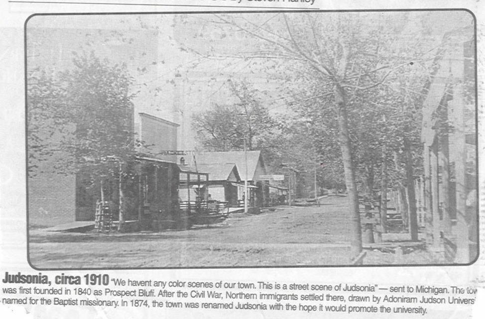
Judsonia 1910
Color Topographical Map
Harry and Flemon found themselves at times not having a place to call
home. They had problems with distant relatives taking advantage of small boys who were
just trying to survive. The knowledge of knowing that just their boat, gun, traps, fishing
pole, and the river was home was a wonderful challenge to them.
The rivers during this time was a great means of transportation. Initially, the White
flows northward from its three points of origin, which is something not many rivers do.
The first point of origin is in Madison County (Arkansas), close to the town of Boston,
Arkansas. The Middle Fork, another point begins in the Ozark National Forest east of
Winslow, Arkansas in Washington County. The third, the West Fork, has its beginnings at
Winslow, Arkansas which claims to be situated on the highest elevation of any incorporated
town in Arkansas some 1,744 feet above sea level. The three forks come together in
Washington County (Arkansas) and combined, move on into Missouri.
From its source in the Ozarks to its entry into the Mississippi, which drains about 40% of the U.S., the White River travels nearly 720 miles and in its earlier days was prone to massive flooding during the spring rains. Many people lived on the rivers in houseboats. There were even floating grocery stores at every major town along the rivers. These boats would buy dressed game animals such as squirrel, and raccoon. Muscle Shells, (more than a dozen kinds were found in the White River) such as hooker-shell, pistol grip, Wabash pigtoe, bleufer, purple pimpleback, and bank climber. they were gathered from the bottom of the rivers by boats with a lengthwise rack on each side that held 8 to 12 foot-long bars. Strings, tied to the bar every 6 to 12 inches, held several "crowsfeet," four-pronged blunt hooks. They would drag the crowsfeet across mussel beds. The mussels were picked up by buyers who had boats. The shells were used for food and also sold as a source of income at major points along White River. These shells were sent to factories to make buttons. De Valls Bluff, Newport and Des Ark had button factories where they took the shells and turned them into buttons. The White River was the major source of pearl buttons for the world at one time. Not too long ago, great numbers of fine fresh water pearls found in mussels in the Newport, Arkansas vicinity made that stretch of the White world famous. Just below where the Cache River flows into the White lies Clarendon once a major shipping point for cotton.
The river bottoms were full of fur bearing animals. The brothers had already learned to trap, hunt and fish before they decided to travel the rivers. So their plan was to fish and collect shells during the summer then hunt and trap in the winter. They had no idea how far they would go but they believed that the best way was down the river floating with the current.
Their return by rail was an adventure on its own riding the Yazoo & Mississippi Valley (Yazoo was an early Indian tribe in Mississippi) from Rosedale, Mississippi through (Bolivar & Coahoma County's) Friar Point, Coahoma, Lula, Trotters Point to Helena, Arkansas . Traveling from there on the Missouri & North Arkansas through West Helena, Lexa, Edgewood, Rondo, Thomasville, Moro, Wheatley, Cotton Plant, Georgetown, West Point, Kensett to Searcy.

Railroad maps 1828 - 1900
DK&S Locomotive No. 1
DK&S Station
Harry and Flemon had many similar adventures over the
next several years hunting, fishing and working in the
area from Hiram
Bluff through Clay where Lewis Bobbitt lived, to Step Rock and Providence. Over this
period
they rode the rails to find work in the harvest fields around Plevna, in Reno County, Kansas at
harvest time.
Flemon at one time worked on the Cotton Belt Route of the Memphis TN, Branch
railway at Fair Oaks in Cross County.
David Coscia's SP site Depots of the St. Louis-Southwestern Railroad Missouri Pacific History

Picture taken on Lowery farm at Step Rock after The Great Arkansas Snowstorm
The Great Snowstorn 15 Jan 1918
in Paragould, Greene Co., AR
June 24, 1903 - The Iron Mountain Railroad established
the first automobile bus line in Arkansas from Kensett to Searcy.
August 1, 1914 - The Germans declared war on the Russians. Camp Pike
(named for explorer Zebulon Pike) was constructed on 13,000 acres of land in Pulaski
County.
August 17, 1917 - The U.S. entered the war. When the first military draft
was held at Camp Pike 43,300 men were received.
January 10-12, 1918 - Great Arkansas Snowstorm probably the most snowfall (19.4 inches in Little Rock) across the state from one storm followed by a severe arctic outbreak producing the lowest temperature's (-13 in February) of the 1900's. Even the Arkansas River froze over so that cars and wagons could cross on the ice.
March 09, 1918 -Great Flu epidemic (Spanish Flu)
(The Great Pandemic) struck
Army camps in Kansas and eventually moved into other states killing as many as 600,000
Americans. After 1,800 cases were confirmed in Arkansas the state was quarantined. Camp
Pike had one of the highest death rates from pneumonia of any other American military
camp. Men died at a rate of 1,000 per each twenty-four hour period in October of 1918. The
epidemic lasted well into 1919, many rural cases were never documented officially.
October 1918 - Flu Epidemic Claims Garner
Brothers of Beebe in WWII
November 11, 1918 - Harry reported to
Camp Pike in Little Rock for service
in the army but the Armistice was announced that day so he was sent back home..
Flemon Benjamin Bobbitt (May 27, 1896 - February 27, 1987) died at the age of 91 and was buried in the Providence Cemetery at Providence, AR.
Clora Bell Bobbitt (4/20/1894 - __/04/1938) buried at Kensett, AR her husband was George Dudley Harder (1/1/1884 - 6/12/1958) They had two sons, Clarence G. & Carl Eugene born and raised in Kensett, AR.
Harry Churchill (May 07, 1999 - July 23, 1998) died at the age of 99 shortly after this book was published. He is buried in the Pleasant Plains Cemetery at Pleasant Plains, AR. Harry was born on his fathers Homestead located on Salado Creek. The mysterious Indian Caves, Pow Wow Circle and Thinking Ledge are in the hills nearby.
John Wesley Bobbitt, Flemon's father (who had a brother who ran a
Hotel on the stagecoach route in MO.?), died at Eureka Springs, AR place of burial is unknown.
Flemon's grandfather John Bobbitt arrived in Washington, DC as a surveyot
about 1810 from Beccles, Suffolk, England.
Henry Churchill (abt 1844 - 1903 on Salado Creek near Newark, AR) whose father was originally from Quincy, IL (Adams County) having at least one brother, Chester and one sister Helen Webb, is buried near Bradford, AR but the location is unknown.
The 1900 US Census of White County, AR, Denmark Township shows that the father of Jim M. Reeves, Kirkwood (Kirk) E. Reeves, age 52, his wife Mellie (Emelia Reden) age, 50 (she was the mother of Mary, Harry and Flemons mother), Henry I. Reeves, age 24 and his wife Mary C. age 27, their son Ben, age 8 1/2, Jim M. Reeves age, 17, Anna C. Reeves, 13 daughter, Minnie B. Reeves, 10 daughter, and Arch C. Robertson, age 15 nephew.
Kirkwood Reeves abt 1867 - 1928 died at State Hospital, Pulaski County
Emelia (Millie) Reden wife of Kirkwood Reeves (abt 1850 - ) (1/4 Cherokee) mother of Mary (Bobbitt) Churchill buried at Olive Branch Cemetery, (Sec 13, Twp 10 N & Rng 7 W) White County, AR
Jim Morgan Reeves (abt 1883 - abt 1949) Roosevelt Cemetery White County, AR
Willie Ben (8/22/1879 - 5/3/1961) & Arpie ( 10/22/1883 - ) Reeves buried in Olive Branch Cemetery (Sec 13, Twp 10 N & Rng 7 W) White County, AR
Mary (Bobbitt) Churchill (Abt 1867 - 10 May 1911) buried Apple Hill Cemetery, west of Ward, AR unmarked, Lonoke County
Louis Bobbitt (abt 1890 - 1911) the older half-brother to Flemon was on the US 1910 Census of White County, AR Clay Township at age 10. He was listed as a slave on the farm of early pioneer William M. Magness, who with his brother John Magness were early settler's of White County. Lewis is buried in Walnut Grove Cemetery, McJester, Cleburne County, unmarked, rear, left corner.
White County Genealogical Links www.bobbittville.com/genealogy.htm
The First White Countain http://www.rootsweb.com/~arwhite/wchs/The_First_White_Countian.html
Department of Arkansas Heritage http://www.arkansasheritage.com/
1850 Census
Powell TWP, Craighead which was then Greene Co., ARDelta Cultural Center www.deltaculturalcenter.com
Arkansas History http://www.segenealogy.com/arkansas/ar_state/history.htm
*1. History of Adams County, IL on the net: http://www.outfitters.com/illinois/adams/history_adams.html
Illinois in the Civil War: http://www.outfitters.com/illinois/history/civil/
Adams County Townships: http://www.outfitters.com/illinois/adams/twpmap_adams.html
Genealogical Society of Adams County: http://www.outfitters.com/~grgs/
Steamboats and Ferries on the White River a heritage revisited by Duane Huddleston, Sammie Rose & Pat Wood